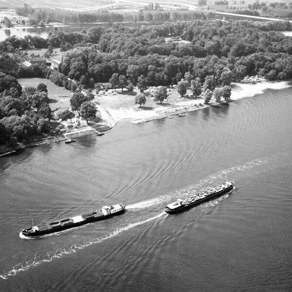
Rettbergsaue
The Rettbergsaue is a natural island, 3,100 m long and up to 400 m wide in places, between the main fairway of the Rhine in the north and the Wachsbleicharm in the south. At 68 hectares in size, it is one of the largest islands on the Rhine.
Until the middle of the 19th century, the Rettbergsaue consisted of two agriculturally used parts, the Biebricher and Schiersteiner Wörth. The western part was acquired in 1832 by the Nassau lieutenant and adjutant to the Duke, Baron Carl von Rettberg, after whom the island was named. However, his cattle and horse breeding failed after a few years and the Rettbergsaue fell back to the Duchy of Nassau.
Since the early 1960s, the Rettbergsaue has been divided by the Schierstein Bridge. In the summer months, access to the island is possible via a staircase on one of the bridge piers. The "Tamara" passenger ferry also transports visitors to the Rettbergsaue, where the Schierstein lido and Biebrich lido were built in 1914 and 1921 respectively; they were closed in 1962 due to the heavy pollution of the Rhine. At the beginning of the 1970s, the Rettbergsaue was to be developed into a local recreation area with vacation apartments, sports facilities and circular hiking trails. These plans failed, as did the construction of a coal-fired power station.
In 1978, three quarters of the area was designated a nature reserve. The publicly accessible areas of the island are a popular local recreation area.
Literature
Forays through the nature of Wiesbaden and the surrounding area. Ed.: Nassauischer Verein für Naturkunde, 2nd verb. u. erw. ed., Wiesbaden 2012 (Jahrbücher des Nassauischen Vereins für Naturkunde, Sonderband 2) [pp. 151-154].
