Iron hand
The mountain saddle (420 m above sea level) northwest of Wiesbaden was already used in prehistoric times to cross the Taunus towards Bleidenstadt and was a road junction that was named the Iron Hand in 1683. A five-pointed iron signpost is said to have stood here, indicating five main directions. However, the name could also derive from an old iron road between the Taunus (Michelbacher Hütte on the middle Aar) and the Rhine (Walluf/Schierstein).
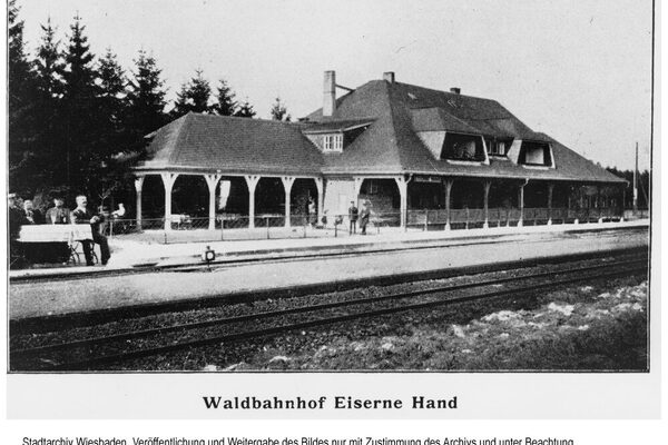
Extensive hikes can be undertaken from the Eisernen Hand, e.g. on the Herzogsweg to the Platte, on the Kaiser-Wilhelm-Weg to the Schläferskopf or to the Altenstein (501 m above sea level), a quartzite rock with a former circular rampart. Eiserne Hand was a stop on the Aartalbahn, the railroad line between Wiesbaden and Langenschwalbach (Bad Schwalbach since 1927), which opened in 1889 and was closed in 1983. The station building was built in the style of the turn of the century; a restaurant building is attached.
Literature
Klein, Elvira: Der Ausflug in den Taunus, Frankfurt am Main 1991.
Quetsch, Joseph: Wiesbaden, Wiesbaden 1957.
Spielmann, Christian: The Wiesbaden country roads in the 18th and 19th centuries. In: Nassauische Annalen 30/1899 [p. 123].
