Westend
The Westend begins west of Schwalbacher Straße. Up to the First Ring, it is referred to as the inner Westend, from then on as the outer Westend. It is bordered to the north by Emser Strasse and to the south by Dotzheimer Strasse. The inner Westend was partly built on as early as the beginning of the 1860s, while development outside the ring road only began towards the end of the 19th century. The inner Westend developed as a district for craftsmen and small tradesmen. The social spectrum of tenants ranged from day laborers to captains.
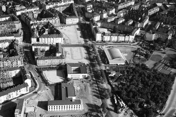
The inner Westend is laid out as a rectangular network of streets with courtyards and rear buildings, workshops and storage sheds. The main axes are Wellritzstrasse and Bleichstrasse, which run east-west. The district was completely built up around 1900. The Platz der Deutschen Einheit is located at the transition to the city center. Three schools shaped the district: the elementary school (1879) in Bleichstraße, formerly the Louise-Schröder-Schule, which today houses the Wiesbaden Business School of the RheinMain University of Applied Sciences, the trade school (1881) in Wellritzstraße, today the Georg-Buch-Haus, and the Elly-Heuss-Schule (1916), formerly Lyzeum II. Wellritzstraße, with many residents of Turkish origin, is also popularly known as "Little Istanbul".
The outer Westend consists mainly of apartment buildings in block construction with a maximum of two rear buildings. The builders were often architects or master craftsmen. In the 1920s, many Jews who had immigrated from Eastern Europe also lived here. A prayer house at Blücherstraße 6 was destroyed in the pogrom night of 10.11.1938. A small center of the outer west end is the Blücher school with the Blücherplatz, today a playground for children and young people.
The streets in the district are named after Prussian-German military officers, which is why the district is also known as the "Feldherrenviertel". Names such as Blücherstrasse and Scharnhorststrasse are reminiscent of the leading players in the wars of liberation against Napoleon, while Elsässer Platz, Elsässer Strasse and Lothringer Strasse commemorate the Franco-Prussian War of 1870/71. The basalt cobblestones, some of which still exist, are typical of the Feldherrenviertel. The Blücherschule was built in 1897 as an elementary school according to plans by the city architect Felix Genzmer, as was the Oberrealschule on Zietenring in 1905, now the Leibnizschule. Another striking building is the church of St. Elisabeth (1936) with its expressionist-influenced style and yellow exterior. The transition between the buildings from the imperial era and the social housing of the 1920s towards Klarenthaler Strasse is harmonious. The triangular block between Klarenthalerstrasse, Goebenstrasse and Scharnhorststrasse was built in 1920/21 for members of the French occupying army. Typical of the houses are their supraports with original motifs.
Today, people from all over the world live in Westend, which has a population of around 16,500. Almost one in two (42.6%) has a migrant background. There is a high level of fluctuation in the district. Only ten percent of residents live here for longer than ten years. Many local artists live in the Westend. A mosque belonging to the Islamic community is located in Hellmundstraße.
Literature
Sigrid Russ, editor, Denkmaltopographie Bundesrepublik Deutschland. Cultural monuments in Hesse. Wiesbaden I.2 - City extensions within the ring road. Ed.: State Office for Monument Preservation Hesse, Stuttgart 2005.
Sigrid Russ, editor, Denkmaltopographie Bundesrepublik Deutschland. Cultural monuments in Hesse. Wiesbaden I.3 - Urban extensions outside the ring road. Ed.: State Office for Monument Preservation Hesse, Stuttgart 2005.