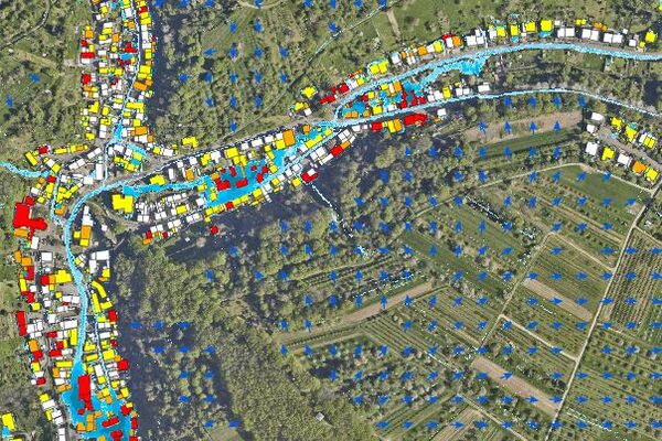
Danger from heavy rain - representation in maps for risk assessment
Heavy rainfall events always bring with them the risk of flooding. Various maps are available to illustrate these risks. They are based on different data sources and therefore vary in detail. What they all have in common is the aim of making areas at risk visible.
Damage caused by heavy rainfall also occurs over large areas and independently of the floodplains of large rivers. The Hessian State Agency for Nature Conservation, Environment and Geology (HLNUG), in cooperation with the RheinMain University of Applied Sciences and others, has developed Hesse-wide heavy rainfall information maps to illustrate large areas. These provide an initial large-scale overview of potential risks to cities or regions in the event of heavy rainfall. For most of the urban area of the state capital Wiesbaden, so-called municipal flow path maps were also made available, which visualize possible paths and directions (flow paths) of heavy rainfall runoff.
The flow path maps are not sufficient to carry out a more concrete risk assessment for the state capital of Wiesbaden. For this reason, the Environmental Agency had heavy rain hazard maps and risk information maps drawn up for the entire area.
Heavy rain hazard map
Heavy rain hazard maps, which calculate the water runoff based on a large amount of individual data and also take into account small-scale features, can be used for specific risk assessments on site. These have been available for the entire city of Wiesbaden since 2023 and can be viewed on the geoportal.
Risk warning card
Risk information maps were derived from the heavy rain hazard maps, which calculate the water runoff spatially. They show the risk of heavy rainfall based on possible water levels at the edges of buildings so that citizens can check for themselves on site whether there is a need for action for their building. The risk information maps are also available on the geoportal.
Contact us
Environmental Agency
Address
65189 Wiesbaden
Postal address
65029 Wiesbaden
Arrival
Notes on public transport
Bus stop Statistisches Bundesamt; bus lines 16, 27, 28, 37, 45, X26, 262
Telephone
Information on accessibility
- Barrier-free access is available
- The WC is barrier-free
