Thematic cards
The thematic maps offer a wide range of information at local and planning area level. The graphical user interface enables a wide range of evaluations.
The data can be viewed from two different angles:
In Map 1, after selecting an indicator, a map showing the distribution across the city area is displayed.
In Map 2, the desired area is first selected on the map. An informative list shows all indicators for the selected area as well as their deviation from the city-wide value.
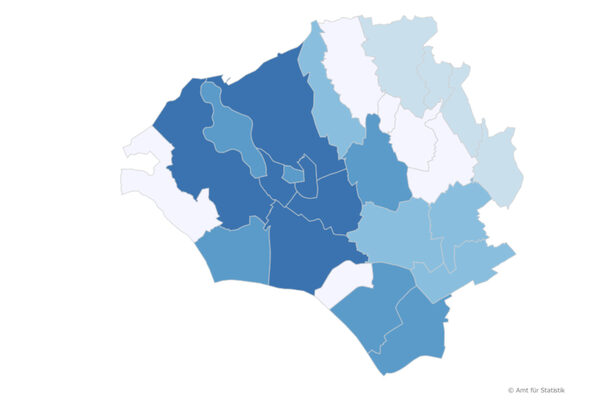
Thematic cards for the yearbook
Many subject areas of the "Statistical Yearbook" are also prepared on a small scale - at the level of local districts and planning areas. Many of the tables are also available in the form of thematic maps. The "individual maps" focus on one feature, which can then be called up in the regions of the city over a longer period of time. The "area profiles" focus on a specific part of the city and show all the characteristics there in comparison to the city as a whole.
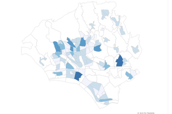
Thematic maps for the district profiles
Most of the features from the district profiles can also be called up in the form of thematic maps. The individual districts can be compared with each other (individual map) and a specific district with all its characteristics can be shown in comparison with the city as a whole, and all this over a longer time series.
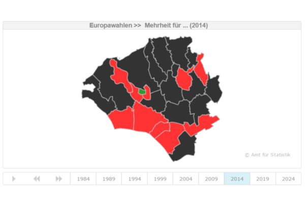
Thematic maps on the election results
The election atlas shows the election results in the Wiesbaden local districts since 1980. After selecting the desired election and party, the local district map shows the vote shares of the party in the 26 Wiesbaden local districts. Time series illustrating gains and losses in the districts are also shown.
Office for Statistics and Urban Research
Address
65183 Wiesbaden
Postal address
65029 Wiesbaden
Arrival
Notes on public transport
Public transportation: Bus stop Dern'sches Gelände or Wilhelmstraße, bus lines 1, 2, 4, 5, 8, 14, 15, 16, 17, 18, 21, 22, 23, 24, 27, 45, 48.
Telephone
- +49 611 315691
- +49 611 313962